الإعصار باد يتحول إلى عاصفة بالمكسيك

This National Oceanic and Atmospheric Administration (NOAA) photo obtained May 24, 2012 shows Tropical Storm Alberto visible in this image from the NOAA GOES-13 satellite taken on March 21, 2012 at 1845z. The first eastern Pacific hurricane of the 2012 season, named Bud, has formed off the southwestern coast of Mexico, the US National Hurricane Center said early Thursday.The category one storm was 385 miles (620 kilometers) southwest of the coastal town of Manzanillo, with maximum sustained winds of 75 miles (120 kilometers) per hour, according to the US monitors. There was no immediate threat from the storm, though the center issued a tropical storm watch for the coastline from Punto San Telmo to La Fortuna, indicating that storm conditions were possible within the next 48 hours. AFP PHOTO/NOAA/HANDOUT/RESTRICTED TO EDITORIAL USE - MANDATORY CREDIT " AFP PHOTO / - NO MARKETING NO ADVERTISING CAMPAIGNS - DISTRIBUTED AS A SERVICE TO CLIENTS
undefined

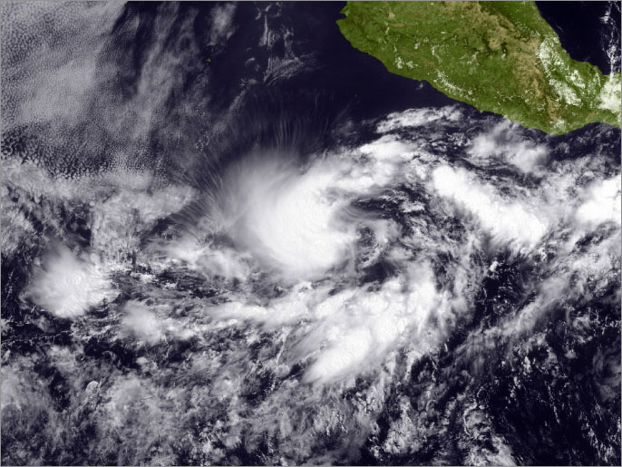
يزداد إعصار "باد" قوة قبالة سواحل المكسيك المطلة على المحيط الهادي, ويتحرك بقوة رياح يتوقع أن تتعدى مائتي كيلو متر في الساعة على مقربة من مدينة مانزانيلو المكسيكية.

وصنف الإعصار من الفئة الثالثة على مقياس سافير سيمبسون للإعصار المكون من خمس درجات.

وقال المركز الوطني الأميركي للإعصار إن "باد" سيؤدي إلى هطول أمطار غزيرة جدا بالمنطقة الغربية من البلاد, كما يتوقع أيضا أن يتسبب هذا الإعصار الأول بموسم أعاصير المحيط الهادي في وقوع فيضانات وانزلاقات أرضية خطيرة. 

والإعصار لا يهدد منشآت نفطية لكنه قد يهدد مدينة بويرتو فالارا السياحية وميناء مانتانيو.

ومن المنتظر أن تنخفض حدة الإعصار بداية عصر اليوم الجمعة.

و"باد" أول إعصار للمحيط الهادي خلال موسم 2012, ويذكر أن موسم أعاصير المحيط الهادي يضم 15 عاصفة استوائية وثمانية أعاصير.

المصدر : وكالات